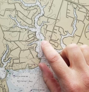
Many in the boating community have recently expressed concern after learning of a proposed plan for the “sunsetting” of paper navigational charts, which was listed among the National Oceanic and Atmospheric Administration’s (NOAA) National Charting Plan, released earlier this spring.

A closer reading of the strategy however, according to the BoatUS Foundation for Boating Safety and Clean Water, reveals a forward-looking approach that sets a course to enable the Office of Coast Survey’s Marine Chart Division to continue to meet the evolving needs of boaters into the future. The member-funded nonprofit Foundation serves as the safety arm for the more than half-million member Boat Owners Association of The United States (BoatUS).
The Way We Access Data
“The way we access data today is different than how we accessed it 10 years ago, and we believe there’s a good chance it will be different 10 years from now,” said BoatUS Foundation Vice President Susan Shingledecker, who serves as the boaters’ voice on the 15-member NOAA Hydrographic Services Review Panel, which advises the federal agency on the nation’s navigational charting needs.
“The National Charting Plan shows that NOAA is looking to evolve its products and use its resources efficiently to meet the changing needs of its users. Having nautical charts available in a range of formats is key to boating safety, and we don’t expect paper charts to go away anytime soon.”
Metric System, Frequency
To ensure concerns were recognized, comments filed today with NOAA by BoatUS Government Affairs said, “BoatUS feels strongly that NOAA’s charting products need to continue to be available in a wide range of formats. …We see some form of paper charts as an essential need for the foreseeable future.”
BoatUS also notes in its comments that charts are likely moving to the metric system and will require boater education. The BoatUS Foundation expects to increase its educational outreach as that occurs.
Among the proposed boater-friendly changes in the National Charting Plan, according to Shingledecker, are more frequent chart updates – weekly, instead of long intervals, and the better integration of data with other agencies such as the U.S. Army Corps of Engineers and the U.S. Coast Guard, which could mean integrating the latest channel depths and aid to navigation positions. The plan also allows NOAA to focus attention on underserved waterways, such as resolving chart discrepancies in areas of importance to recreational boaters.
More Efficient Chart Production
“We see a more efficient chart production that allows more frequent updates of obstructions, discrepancy resolution and exploration of using crowd-sourced data,” said Shingledecker. “Boaters on the Intracoastal Waterway, for example, need to know what the channel depth is today – not what it was last year. The plan is simply a starting point to get us there.”
NOAA also responded to boaters’ concerns in a blog post today, ensuring boaters that, “The draft plan does not offer a timeline for ending the production for NOAA paper charts or (Raster Navigational Chart) data. We expect this process may take decades to complete, as user communities continue to adopt electronic navigation and our production system and products continue to improve.”


